
Data-driven Webcams for Smart Cities
How Panomax Webcams support Smart Cities

Clear planning foundations: cities are constantly evolving. Our Smart City webcams make these changes visible, providing clear images of key locations at all times. They help cities monitor developments, interpret trends, and plan proactively.
Interactive communication: by combining live footage with interactive layers, a new form of urban communication emerges. Infrastructure, public spaces, and mobility offerings become visible, understandable, and tangible—for both decision-makers and residents.
Centralized hub: Panomax connects existing city data sources and visualizes them directly within the live image. Information is displayed where it matters most. With Panomax webcams, everything is in one place, clearly structured, and always accessible.
Smart City data made visible
Important webcam features for Smart Cities
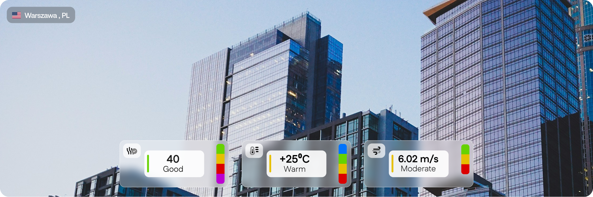
DATA DISPLAY - API
Panomax is able to gather data from multiple sources in your city, and embed it directly into the live view. The centralized information is easily accessible, and logical to understand.
INTEGRATED WEATHER DATA
Panomax integrates live meteorological information directly into the panoramic view of your city - linking each image with real conditions at the time it was captured. See more!
CITY DEVELOPMENT ANALYSIS
See your location evolve through time. Panomax helps you compare your location over days, years and decades. Discover changes in the urban landscape, seasonal differences, and shifting activity patterns at a glance. See more!
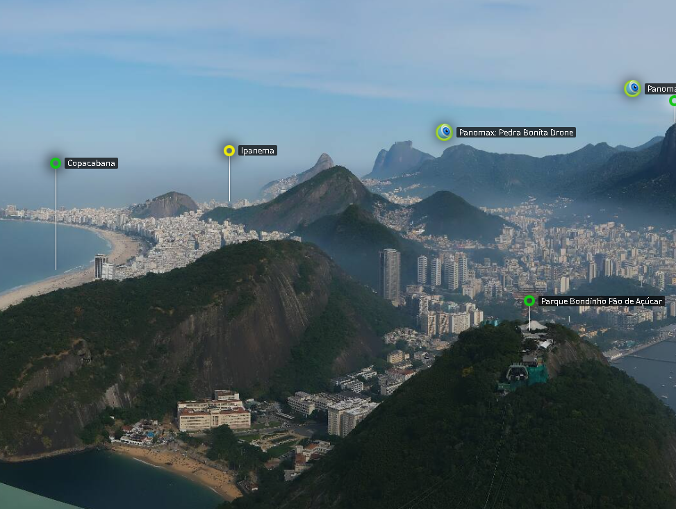
Smart City webcams from Panomax projects

All of your city’s data in one place
Increase visibility and showcase your location or project with personalized branding and promotional opportunities.


Testimonials